WELSH LAKES
TRAIL REPORTS
MAPS
PHOTOS
WELSH LAKES
4.19 km
Length
515 m
Elevation gain
TRAIL DESCRIPTION
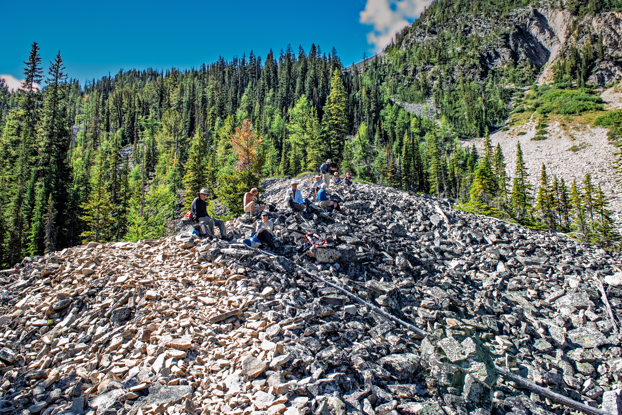
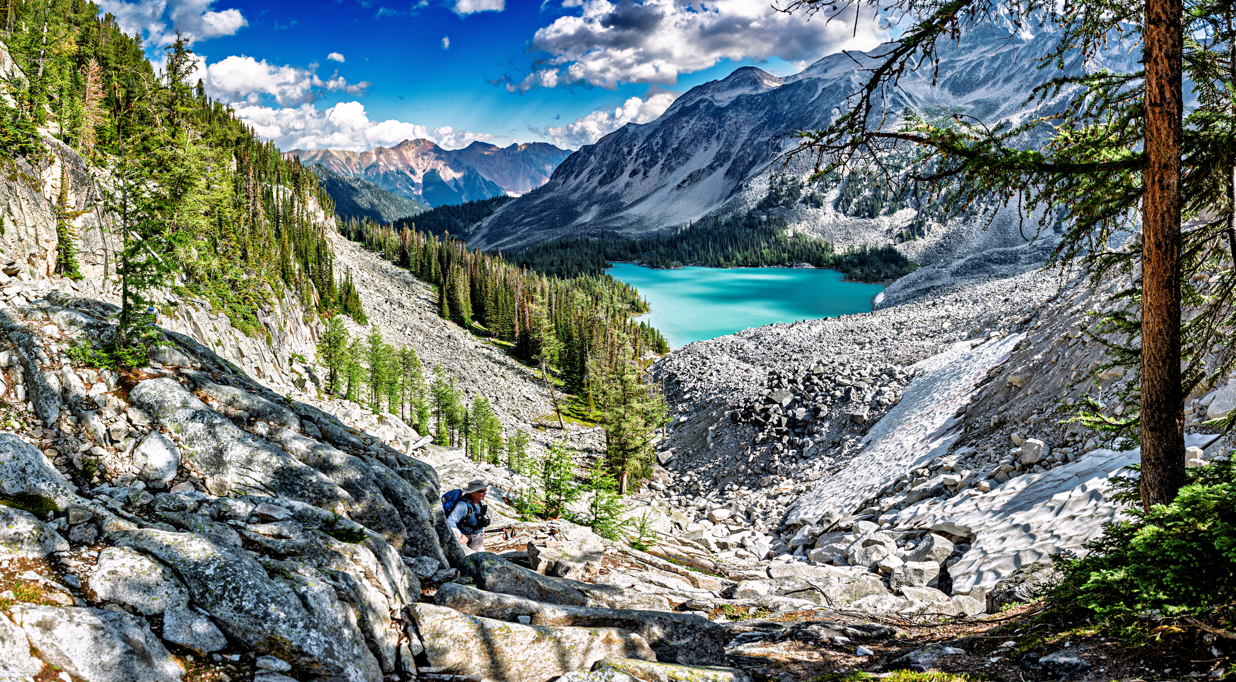
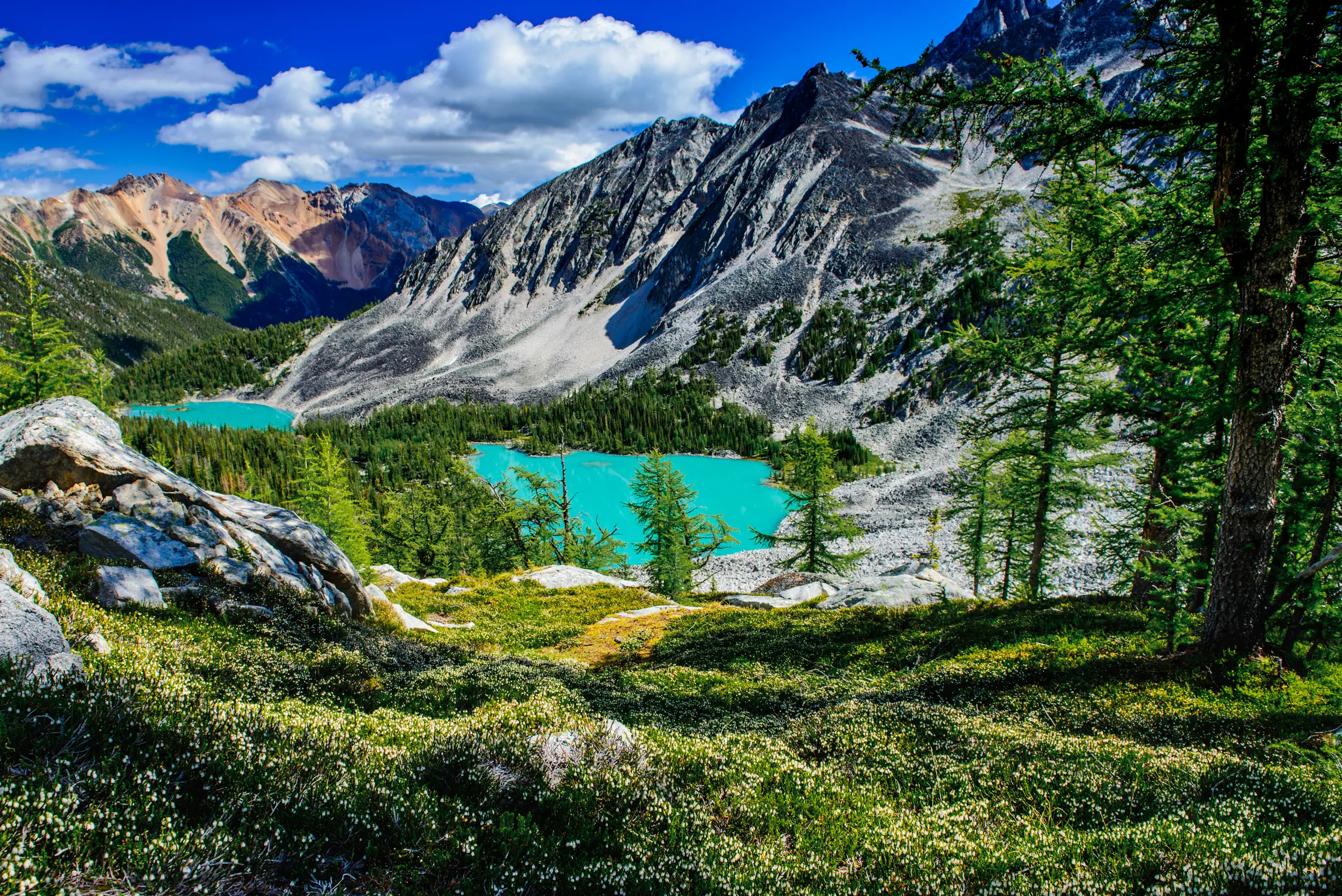
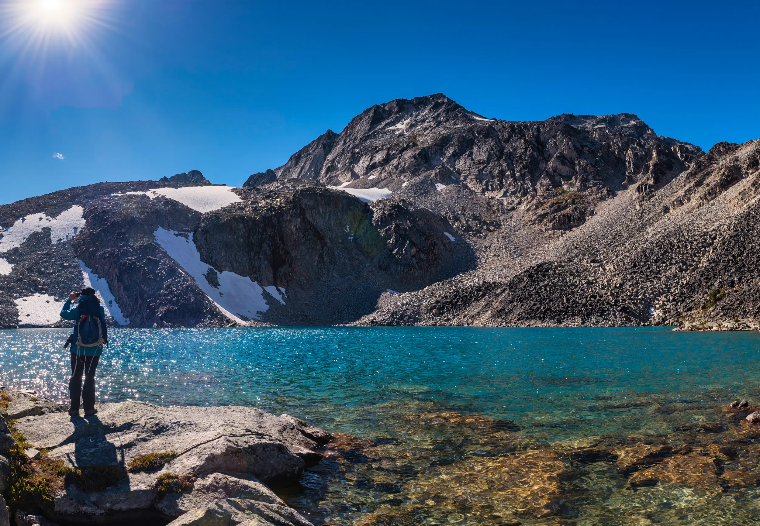
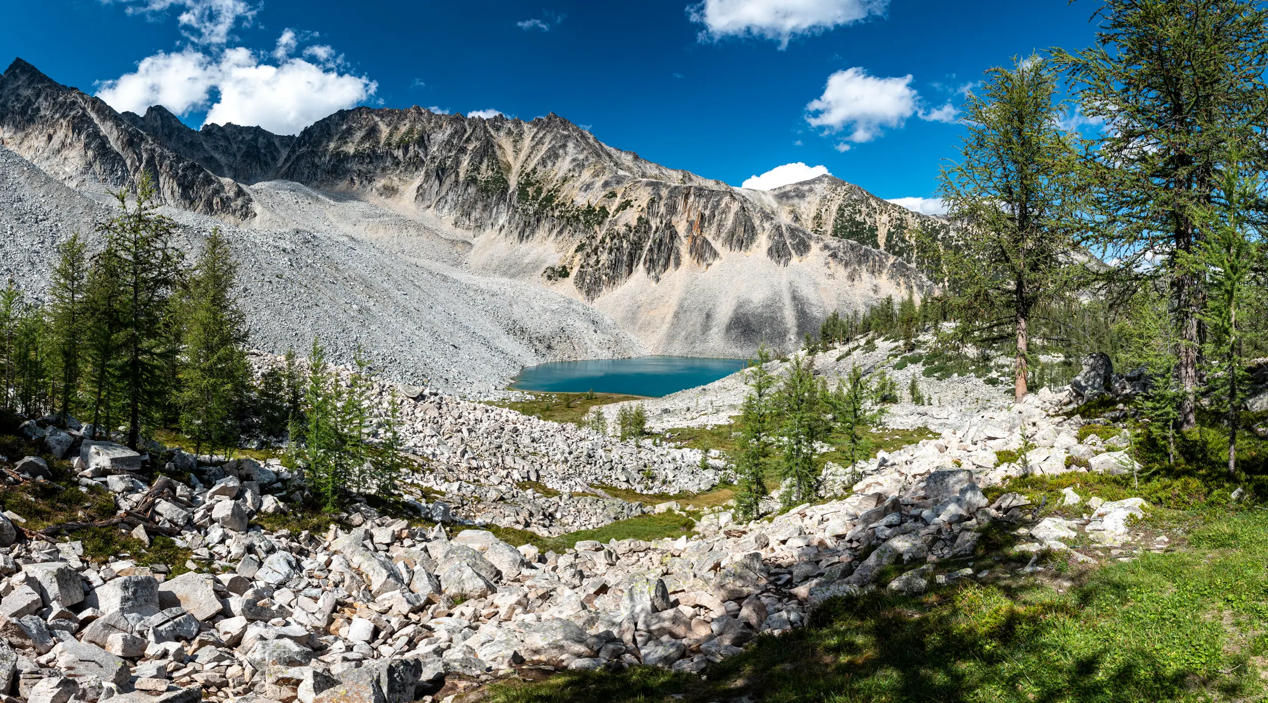
After crossing Welsh Creek on a footbridge, the trail follows an old road bed for about 2 km. The trail leaves the roadway and climbs steeply through the forest before opening onto an expansive talus slope of granite rocks. Keep to the left hand side of the talus field. A faint trail and rock cairns lead the way up through the rocks. The grade increases significantly for the final 300 m of elevation gain before arriving at Lower Welsh Lake (4.5 km, elevation 2150 m)). Rest here or continue on to Middle Welsh Lake and the Upper Lakes Circuit.
The trail continues over a rocky peninsula to the lake’s inlet, where a sign (right) indicates the route to Aberystwyth Lake. If you are not planning to hike the complete circuit this is the shortest route to Aberystwyth Lake (1 km). The route stays to the right of the rock slide. It is steep and marked by cairns and flagging.
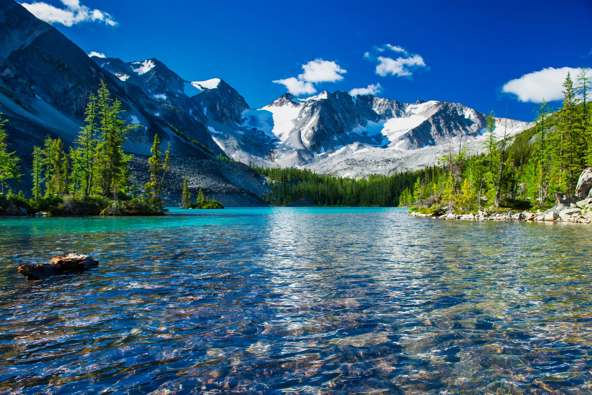
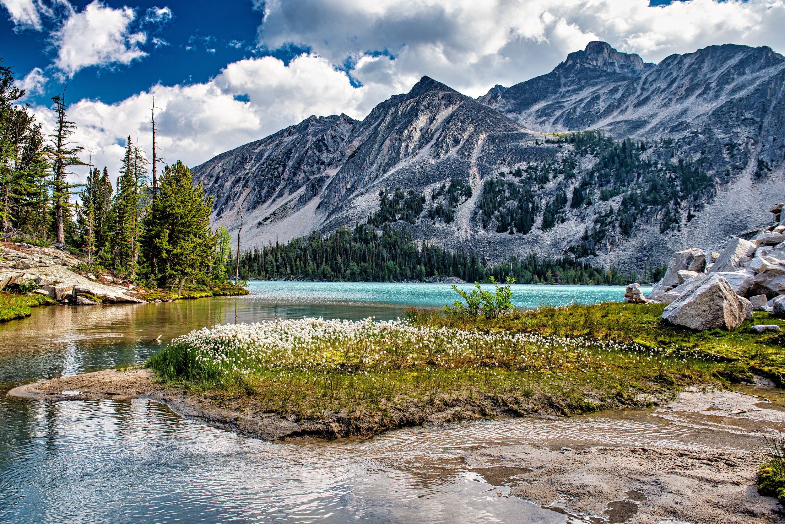
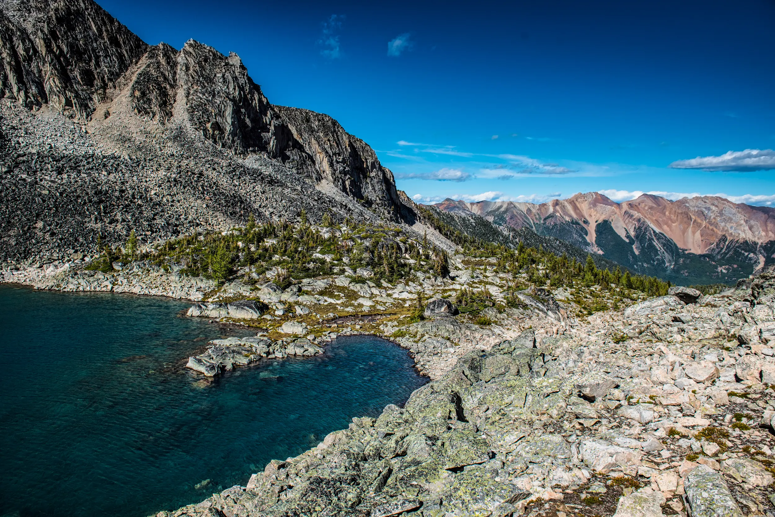
If you want to hike the complete circuit (5.5 km) stay on the main trail. Shortly after is the junction to the campground (left). There are 8 tent pads, 2 tables, a bear bin and a pit toilet. Continue on to reach Middle Welsh Lake. The Upper Lakes Circuit begins at the end of the lake. This is a wilderness, route-finding trail, marked by cairns and flagging. The route climbs through rocks and meadows to Upper Welsh Lake (elevation 2400 m), then follows a relatively gentle grade through meadows and open forest to Aberystwyth Lake. Cross the creek a short distance from the lake and follow the steep route back down to Lower Welsh Lake.

TRAIL MAP

DRIVING DIRECTIONS
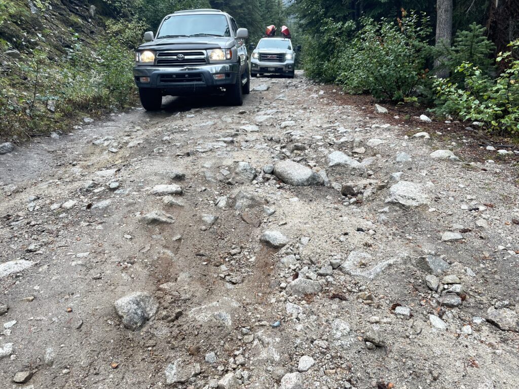
High clearance vehicle recommended/watch for logging trucks. Set your odometer to zero at the traffic lights on Highway 93/95 at the Invermere junction. Go west into Invermere. At 2.6 km turn right onto Panorama Drive. At 4.5 km just after the Toby Creek Bridge, turn right toward Wilmer. At 7 km turn right onto Main St and drive through Wilmer onto Westside Road. At 17.8 km turn left onto Horsethief Forest Service Road. At 22 km turn right at the Y-junction onto Forster FSR. At 27 km turn right at another Y-junction. The road then passes a reservoir on the left and crosses a bridge, stay to the left. At 28 km turn left to stay on Forster FSR. At 45.2 km take the road to the left at the sign for the Welsh Lakes trail. The 1.5 km access road is steep, narrow and rocky. High clearance and 4×4 recommended, or park at the bottom and walk the last 1.5 km to the trailhead. It ends at 47 km at the trailhead. 1.5 – 2 hour drive from Invermere.
TRAIL REPORTS
Welsh Lakes July 8, 2026
Road up to the access road is in better shape than usual. Deep ruts have been graded. Access road is rough as usual and requires high clearance 4×4.
Trail cleared up to talus slopes and in good condition. Foot bridge near start of trail will require repairs.
Welsh Lakes July 16, 2025
Forster FSR has the usual potholes and deep ruts around the 30km mark. High clearance vehicles recommended particularly for the last 1.5 km of road, or park at the bottom of the access road. Trail in good condition. Mosquitos at campsite are active!
Welsh Lakes October 15, 2023
Primitive Campsite Established
With the funds raised by STMS and the help of RSTBC, a primitive campsite with 8 tent pads, 2 tables, a bear bin and a pit toilet has been established by Starr Trail Solutions. Starr Trail Solutions also worked on trail improvements around the first two lakes. The tent sites can not be reserved and will be on a first come basis.
This STMS project was made possible by the support and donations from: Columbia Basin Trust, Lions Club, RSTBC, and Rotary Club.
TRAIL PHOTOS