ASSINIBOINE LAKE
TRAIL REPORTS
MAPS
PHOTOS
ASSINIBOINE LAKE
TRAIL DESCRIPTION
Fine views, tumbling streams and two mountain lakes (You can visit Lunette Lake on the way to Lake Assiniboine.) make hiking this trail a satisfying backwoods experience.The path is well defined from the parking area and the first stream crossing should be easy with a large stump newly installed for your convenience. Watch for forest birds and creatures attracted by the healthy forest and clean water.
The first ½ hour you will wind through dense berry patches ( Beware if hiking in the autumn, as these attract the local bears.) and then climb a dry ridge. On the other side you will descend to the picturesque east bank of the pristine Assiniboine Creek. The trail follows the creek closely, but is sometimes a bit faint if there has been rain.
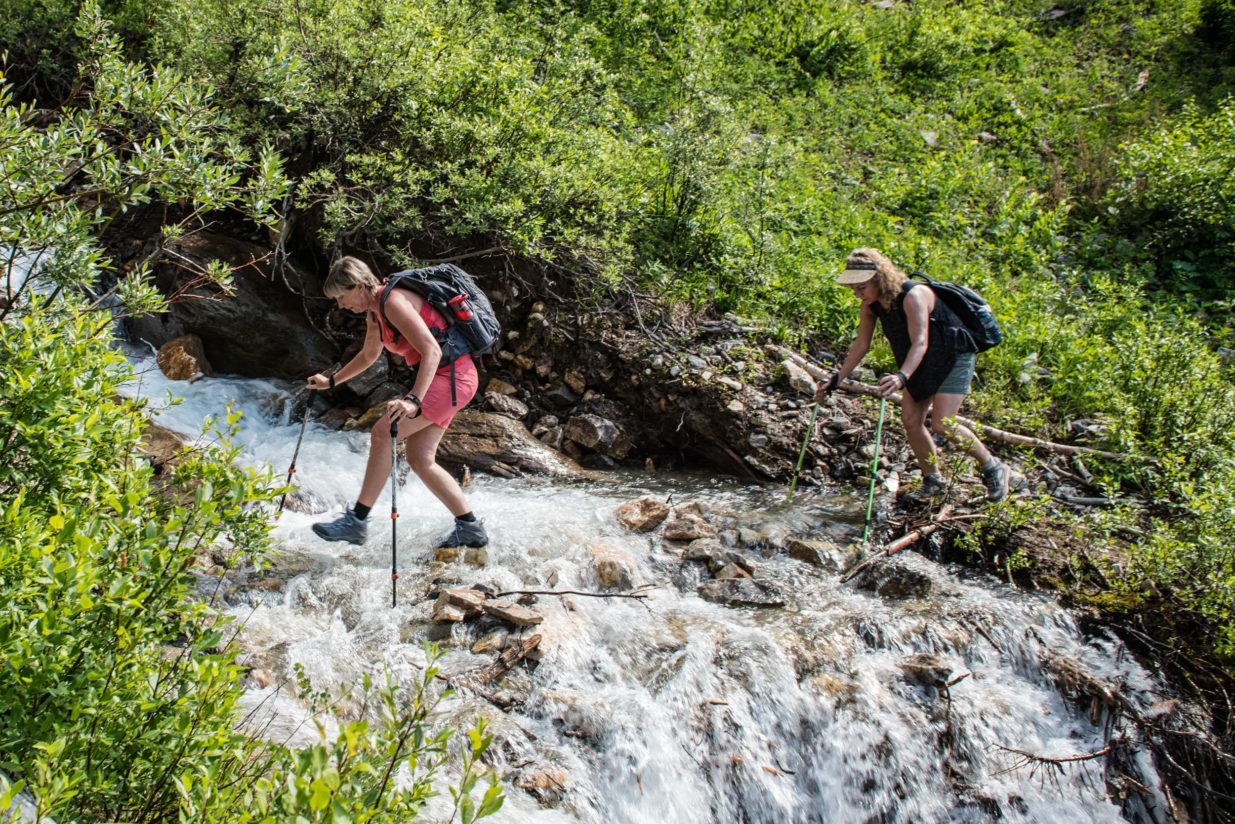
At about 3.5 km from the trailhead, you must make an exciting but precarious creek crossing. The logs on this “bridge” have been cross cut to help with footing and a steadying cable has been tightened to assist you. Still, all of your party members may not wish to risk the crossing as the creekbed is rocky and the water very turbulent.
A little farther in , a tiny run off stream invades the trail at times so there is a flagged route around that. Also, there are couple of little log crossings over wet spots . All deadfall was cleared from the trail in September 2019, but of course there will be more.
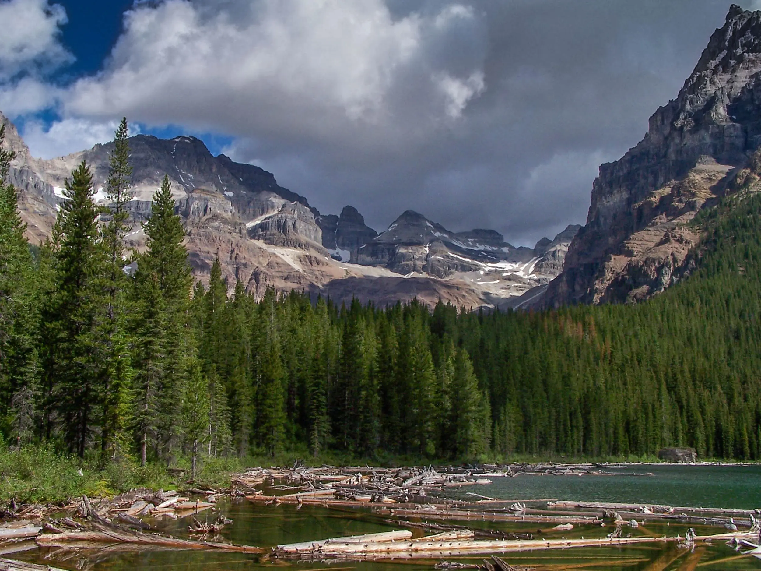
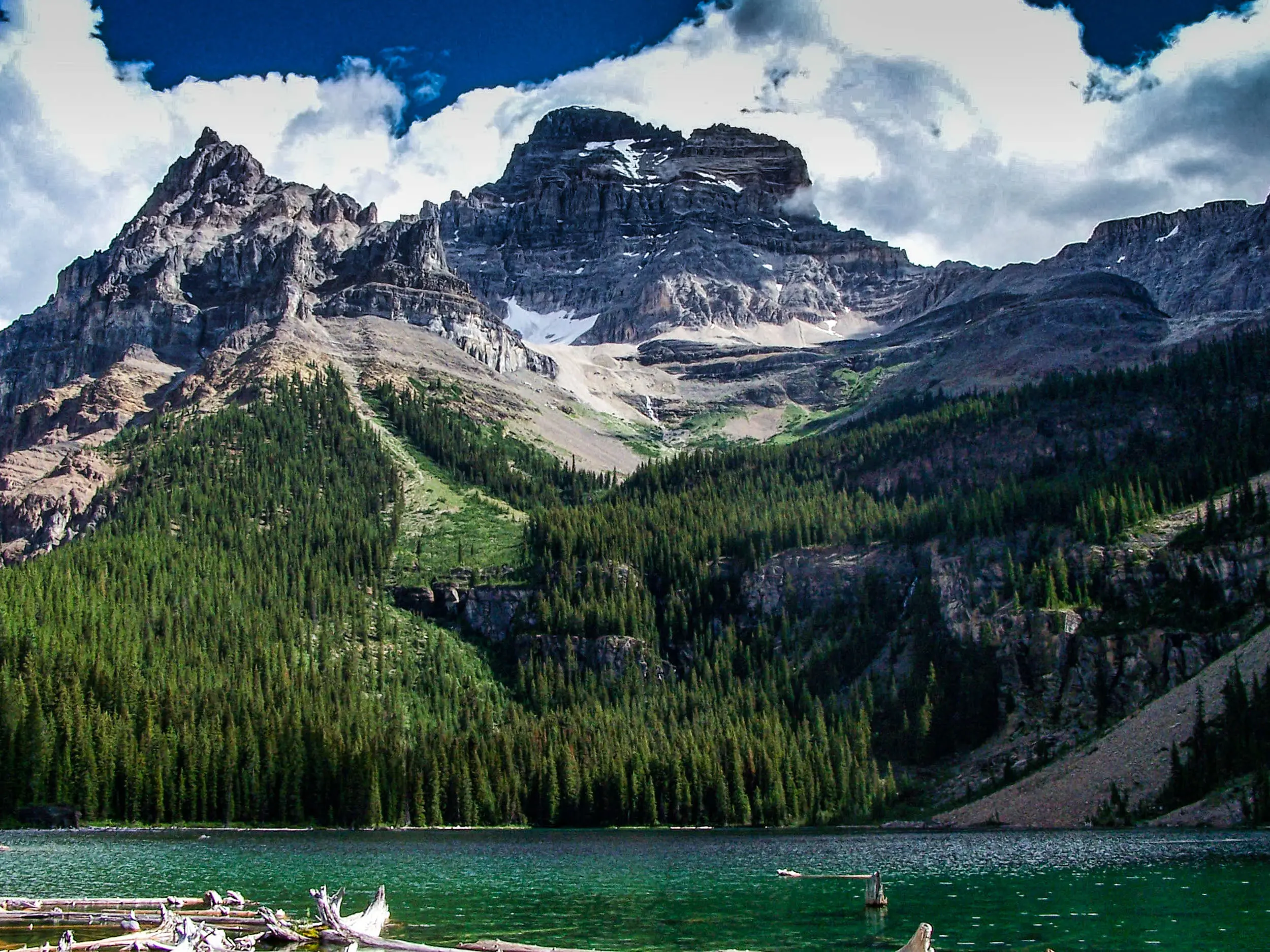
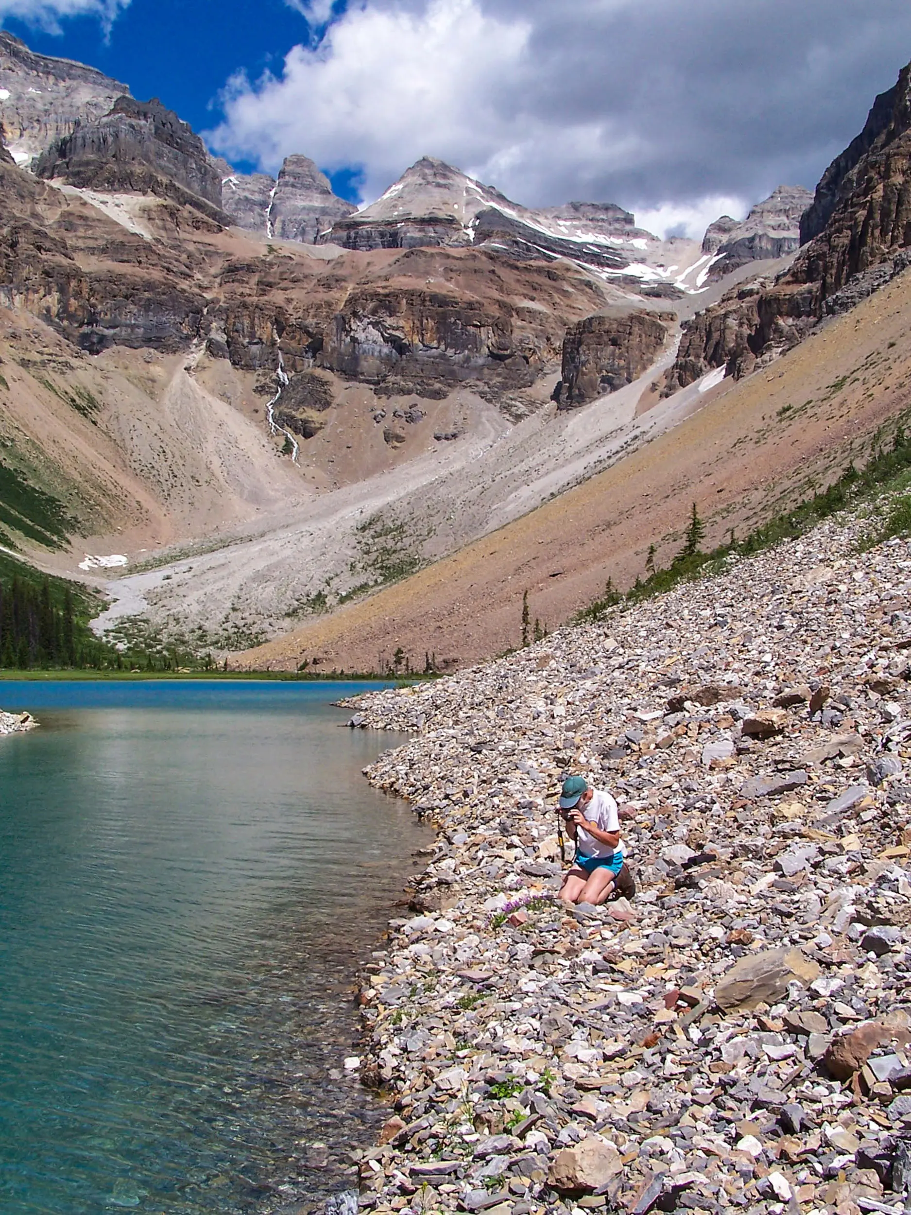
After another km you will find a faint path to the right which goes to Lunette Lake. Look for the small rock cairn indicating the turnoff. This trail follows Lunette creek up hill to the lake. This is a short and easy detour that will provide views of Mount Assiniboine, Lunette Peak and Mount Sturdee.
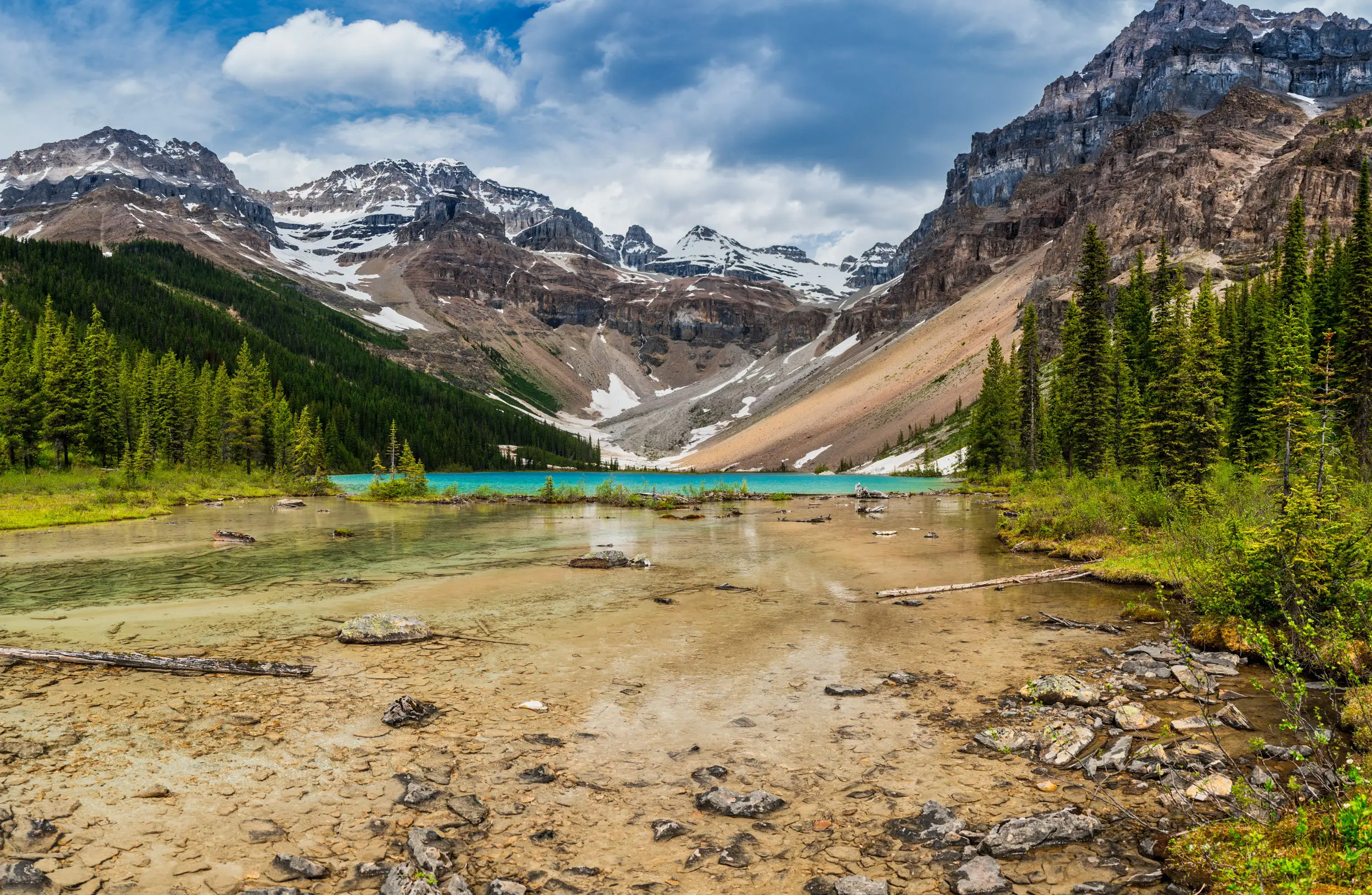
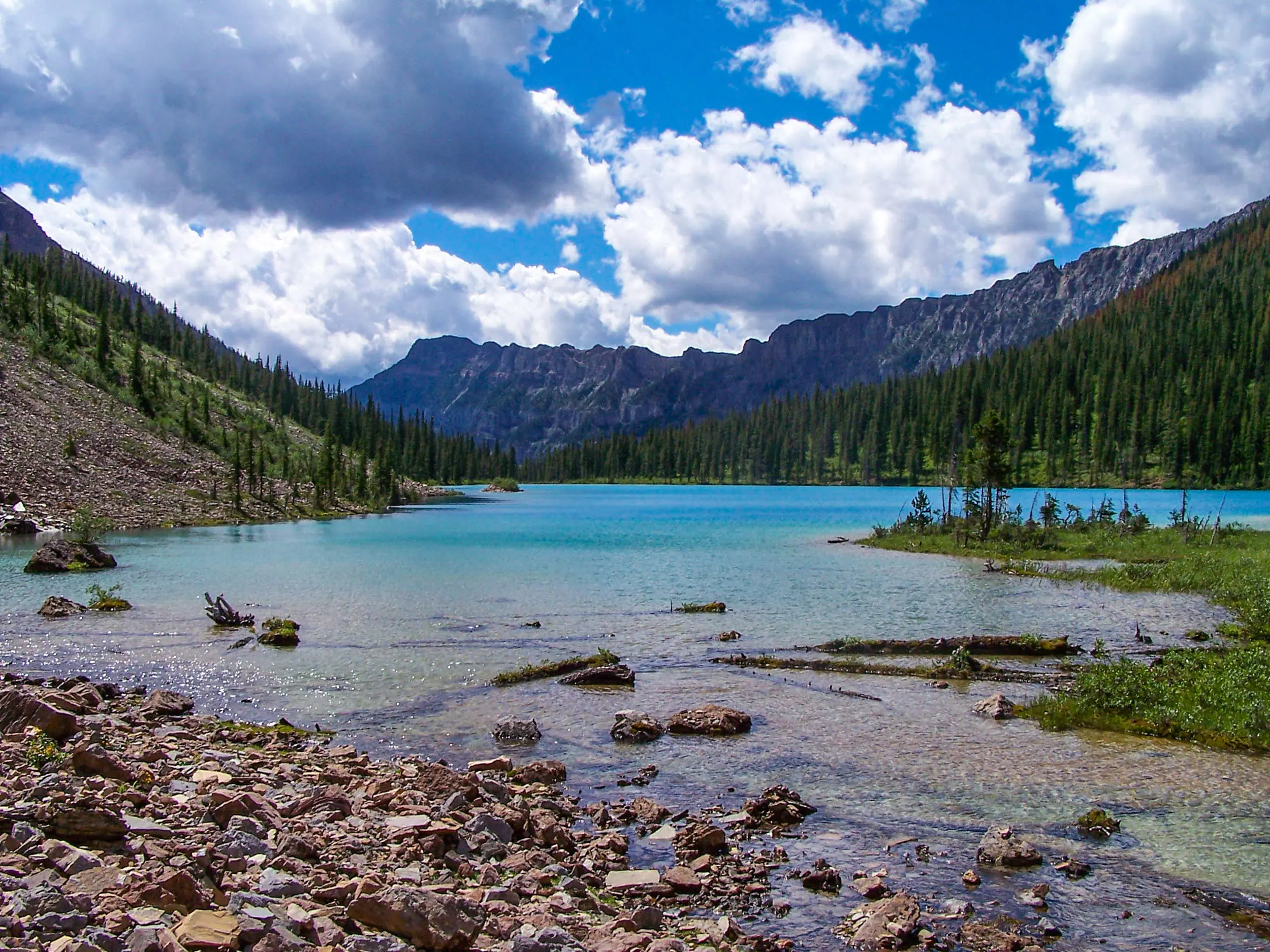
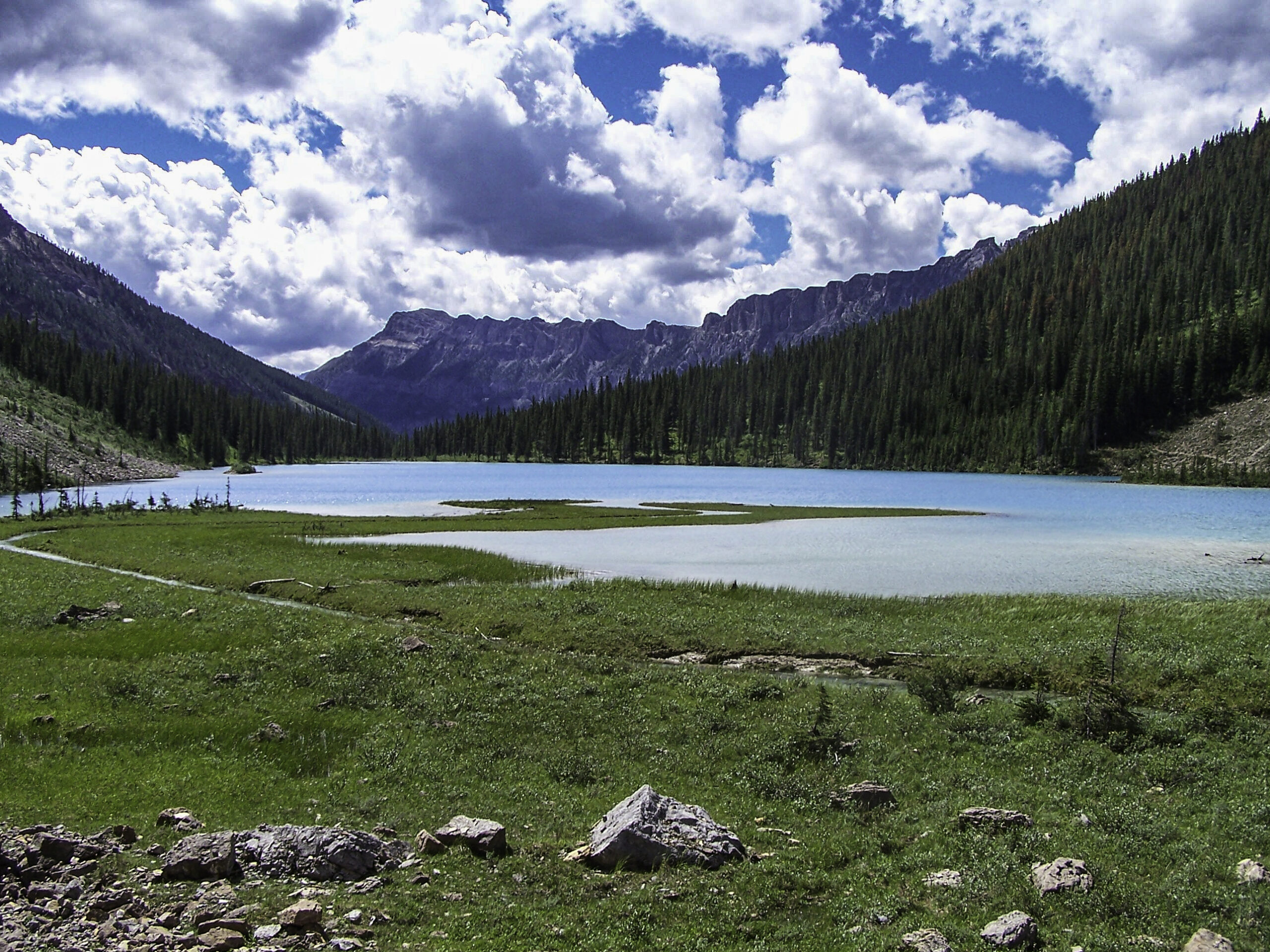
Once you are back on the main trail, continuing north, you will be about 1.3 km from the south shore of stunning Assiniboine Lake. There is an inviting campsite just near the shore. You might want to come prepared to stay over.

TRAIL MAP

DRIVING DIRECTIONS
Directions to the trailhead: (4 x 4 or high clearance preferred but a car can access this hike)
• Drive north on Hwy. 93/95 to and through the Kootenay Park gates at Radium. Continue east on Hwy 93.
• At 18.1 km, turn right on to Settlers’ Road. There is signage to prepare you for the turn
• Down the Settlers’ Road, turn left on the Kootenay Palliser Forest Service Road (FSR) This is just before a 12 km marker on the road and goes toward the Palliser and Cross Rivers.
• Turn left on the Cross River FSR.
• Turn left on the Mitchell River FSR.
• Turn right, just before the bridge and in view of the Baymag mine. There is no sign at the turn, but it is flagged. If you arrive in the huge compound of the mine, you have gone a bit too far.
• The trailhead and parking for Assiniboine Lake are on the left after the second drive over bridge. There is no sign except for a very small green hiker sign on a tree. The trail is easy to find, and straight ahead from the clearing where you park is the sign in box with book inside. This is just out of view of the parking area.
The trip from Radium should take @ 1.5 hours.
TRAIL REPORTS
Assiniboine Lake June 13, 2024
The maintenance crew has been out to clear deadfall. Road conditions are good to the mine. Alders are growing in past this point. The trail is clear of snow to the lake.
Assiniboine Lake September 2, 2023
The trail is in good shape and as well as the log bridges. There are 4 large trees across the trail but are easy to get by.
TRAIL PHOTOS